IP66 Slope GPS Land Meter Instrument Tool For Land Survey S2
Product Parameters Of Model S2 GPS Land Survey Equipment :
| Functions | | | | S2 |
| Normal area measurement | | | | √ |
| Fixed area measurement | | | | √ |
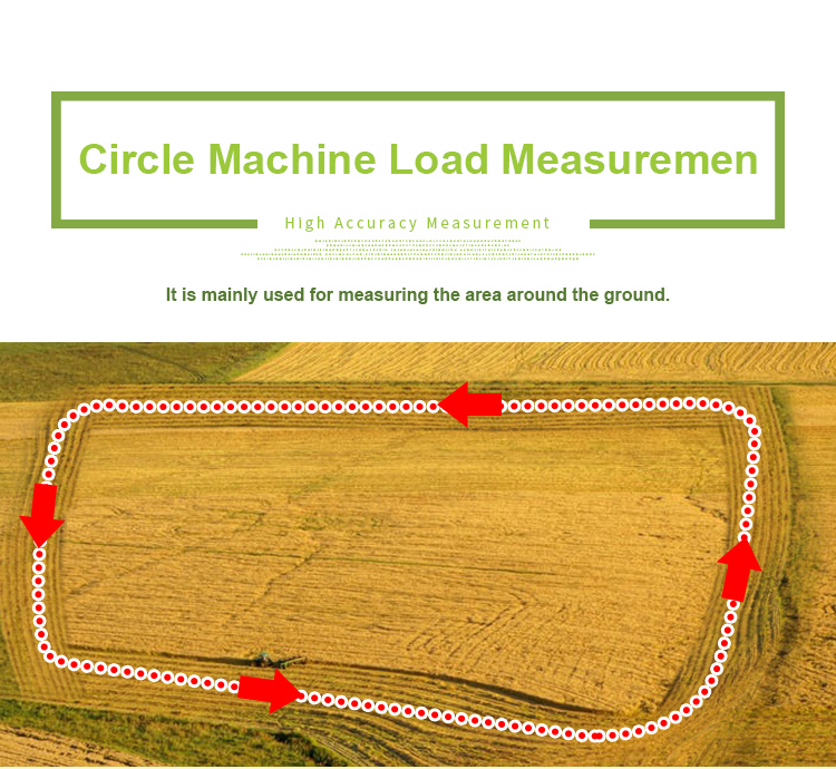
| Machine load area measurement | | | | √ |
| Slope area measurement | | | | √ |
| Intell. Slope measurement | | | | √ |
| Fixed point measurement | | | | √ |
| L/W area measurement | | | | √ |
| Mountain area measurement | | | | √ |
| Normal distance measurement | | | | √ |
| Multipoint distance measurement | | | | √ |
| Slope distance measurement | | | | √ |
| Altitude display | | | | √ |
| Altitude measurement | | | | √ |
| Track display | | | | √ |
| Real-time track | | | | √ |
| Mu setting | | | | √ |
| Unit setting | | | | √ |
| Time display | | | | √ |
| Data statistics | | | | √ |
| Historical record | | | | √ |
| Data export | | | | √ |
| Car charger | | | | √ |
| Lighting /Currency detection | | | | √ |
| Voice broadcast | | | | √ |
| Protection level | | | | IP66 |
Machine Operation Methods:
HDOP setting of GPS land meter:
① On the home page of boot,press the【Settings】button to enter the settings interface;
② Press the▲▼button move to “HDOP setting”;
③ Press the【Enter】button to enter;
④ Press the▲▼button to adjustment HDOP numerical value.
⑤ Press the【Enter】button to save and exit.
Note: Measurements can only be made if the value is lower than or equal to the set value.
Elevation calibration of GPS land meter:
① On the home page of boot,press the【Settings】button to enter the settings interface;
② Press the▲▼button to move to“Elevation calibration”;
③ Press the【Enter】button to enter;
④ Press the▲▼button to adjustment the number,and press the【Enter】button to complete the calibration.
⑤ Press the【Enter】button to save and exit.


Product Tags:

|
|
IP66 Slope GPS Land Meter Instrument Tool For Land Survey S2 Images
|


